


利用について / Use of the Peace Learning Archive in OKINAWA
このページでは平和学習アーカイブの使い方を解説していきます。 初めに、平和学習アーカイブを使うときはパソコンがインターネットに接続されている状態にしてください。本アーカイブは随時サーバーからデータを受信して詳細な地図を表示するので、インターネットに繋がっていないと地図が表示されません。 / This page explains how to use the Peace Learning Archive in OKINAWA. First, when using this Archive, connect your computer to the internet. This Archive displays streaming imagery and detailed mapping received from the server, so it is best to be connected to the internet to view these maps.
沖縄平和学習アーカイブwebのTOP画面からDigital Earthで観覧するをクリックしてください。 / Go to the top page of the Peace Learning Archive in OKINAWA website, and click to view with Digital Earth.
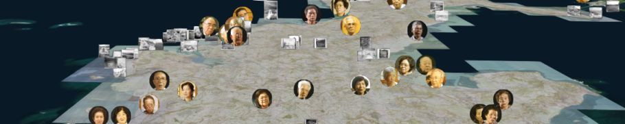
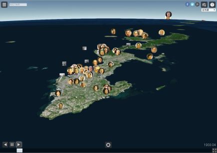
沖縄平和学習アーカイブ(The Peace Learning Archive in OKINAWA)の画面が起動します。 / The Peace Learning Archive in OKINAWA page will start up.
沖縄平和学習アーカイブの利用方法 / How to Use of The Peace Learning Archive in OKINAWA
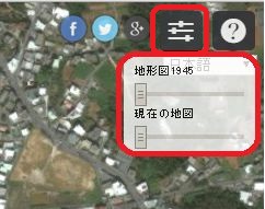
右上のスライダーアイコンをクリックすると地図の切り替えスライダーが表示されます。これをスライドさせることで、1945年当時の地形図と現在の地図を表示することができます。スライダーの位置で透明度を変更できるので、航空写真に地図を重ねてみることができます。 / When a slider icon in the upper right is clicked, a change slider on a map is indicated. It's possible to be to make this slide and indicate a topographical map in 1945 and the present map. The clarity can be changed at the location of the slider, so it's possible to pile a map on an airscape.
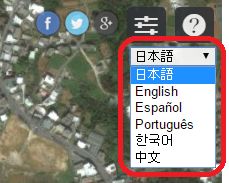
また右側上部には日本語、英語、中国語、韓国語、ポルトガル語、スペイン語で観覧できるようになっています。 / Available on the upper right are various languages for the user to choose from; Japanese, English, Chinese, Korean, Portuguese, or Spanish.